Ix · World Map
The Maps of Dort
The world of Dort and its six lands, as a literate traveller can buy, borrow, or copy them. Open any map at full size to read every city, river, and range on it.
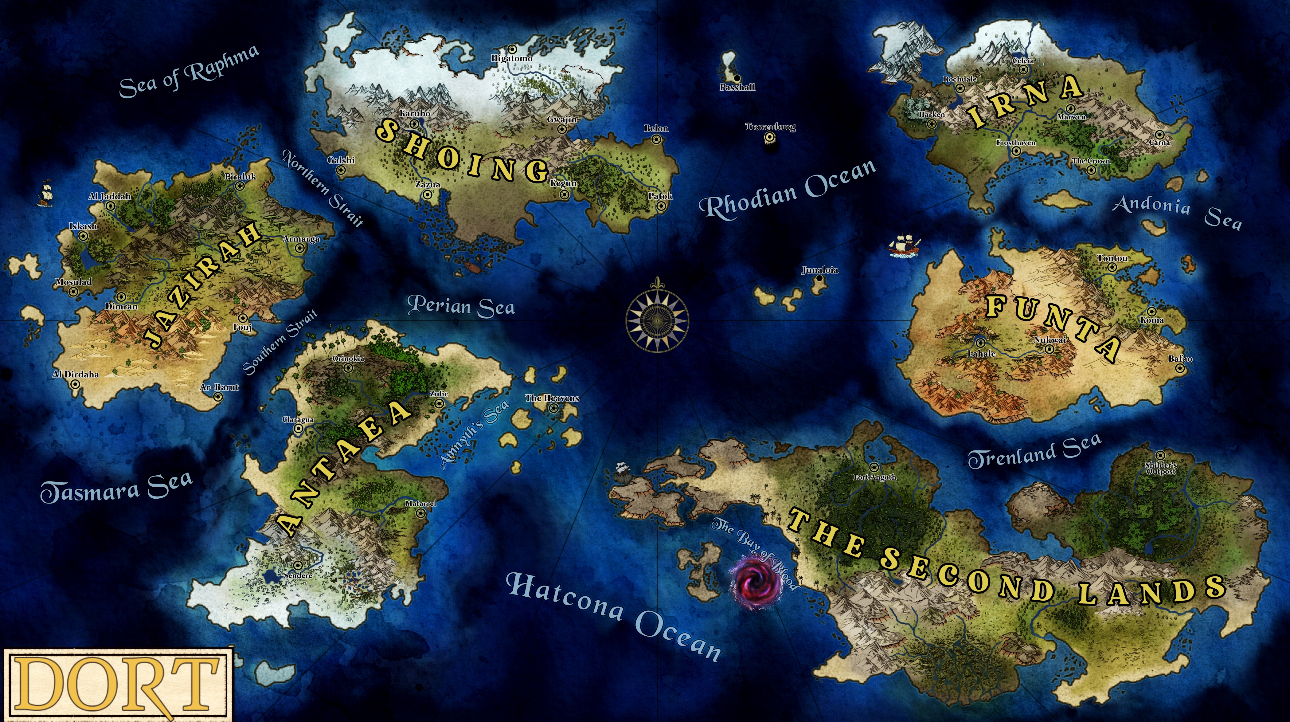
The World of Dort
Irna and Funta in the east, Shoing in the north, Jazirah in the west, Antaea and the Second Lands in the south. Between them lie the islands of the Oceanic Reaches, among them Passhall, Travenburg, and Junaloia.
Map by Luis Leopardi
The Lands of Dort Cities and Realms Notable Places The Oceanic Reaches Full-size image 4200 × 2350
Regional maps
-
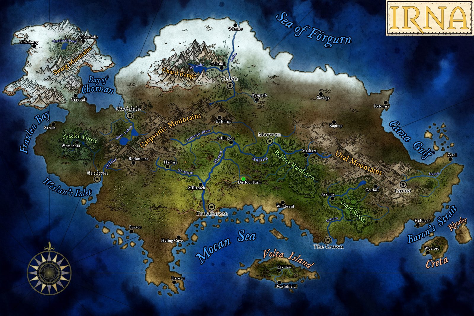
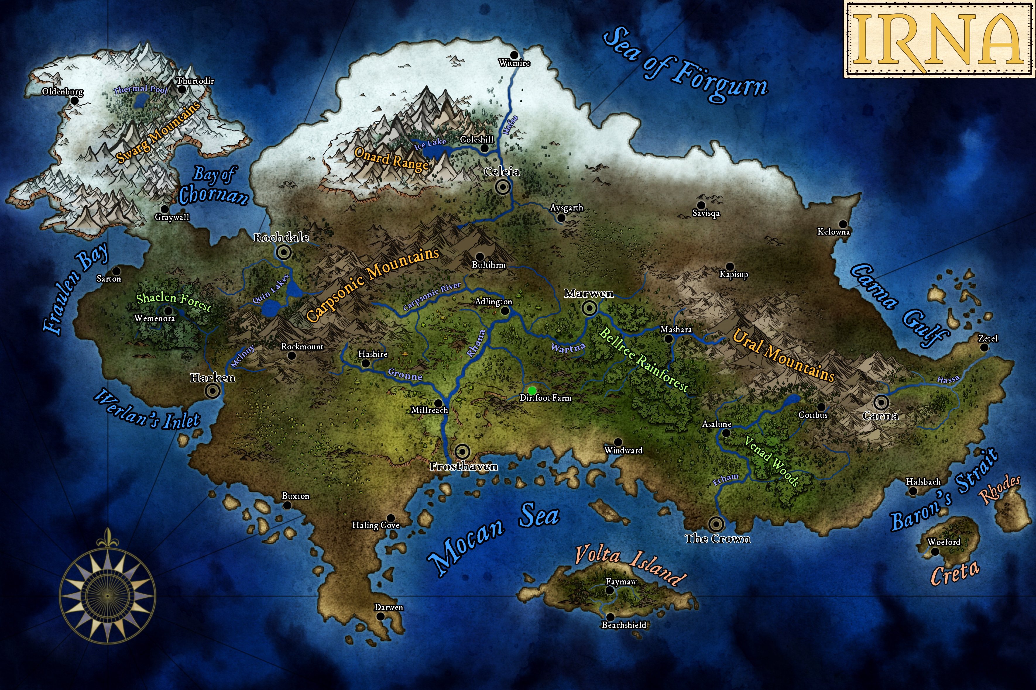
Irna
The oldest political center of the known world. The Crown sits on the southern coast; Frosthaven, Rochdale, Harken, Marwen, Celeia, and Carna are the seats of its kingdoms.
Map by Luis Leopardi
-
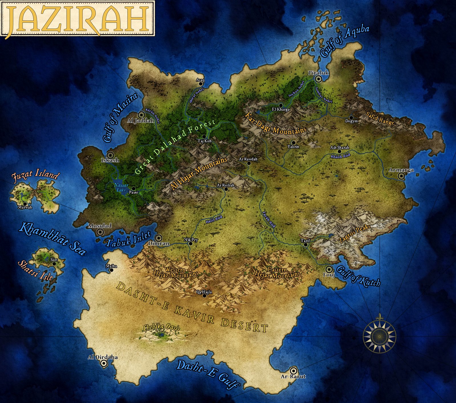
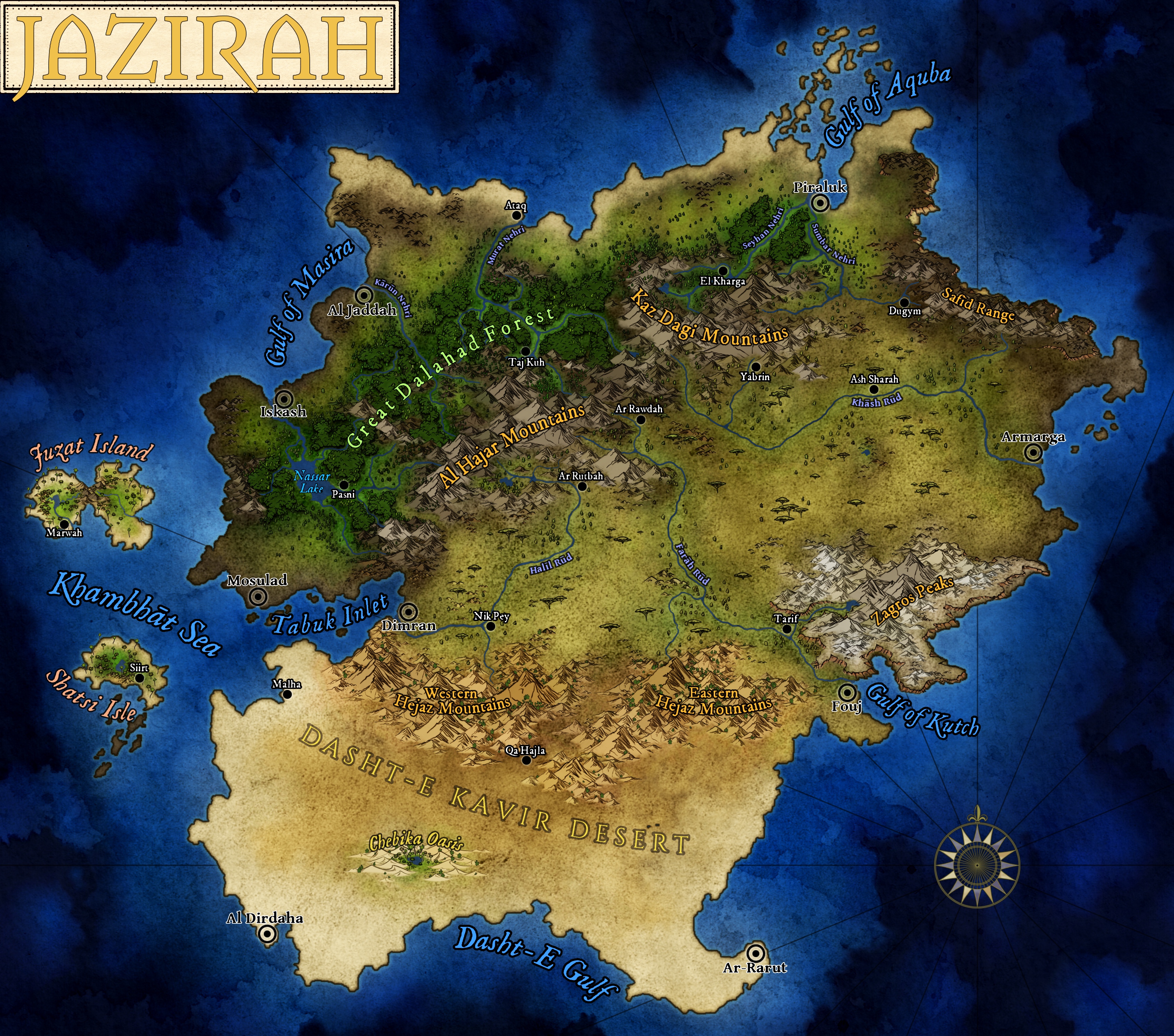
Jazirah
Iskash, the Order's capital, and Al Jaddah, the holy city, stand on the western coast; the Dasht-e Kavir Desert fills the south.
Map by Luis Leopardi
-
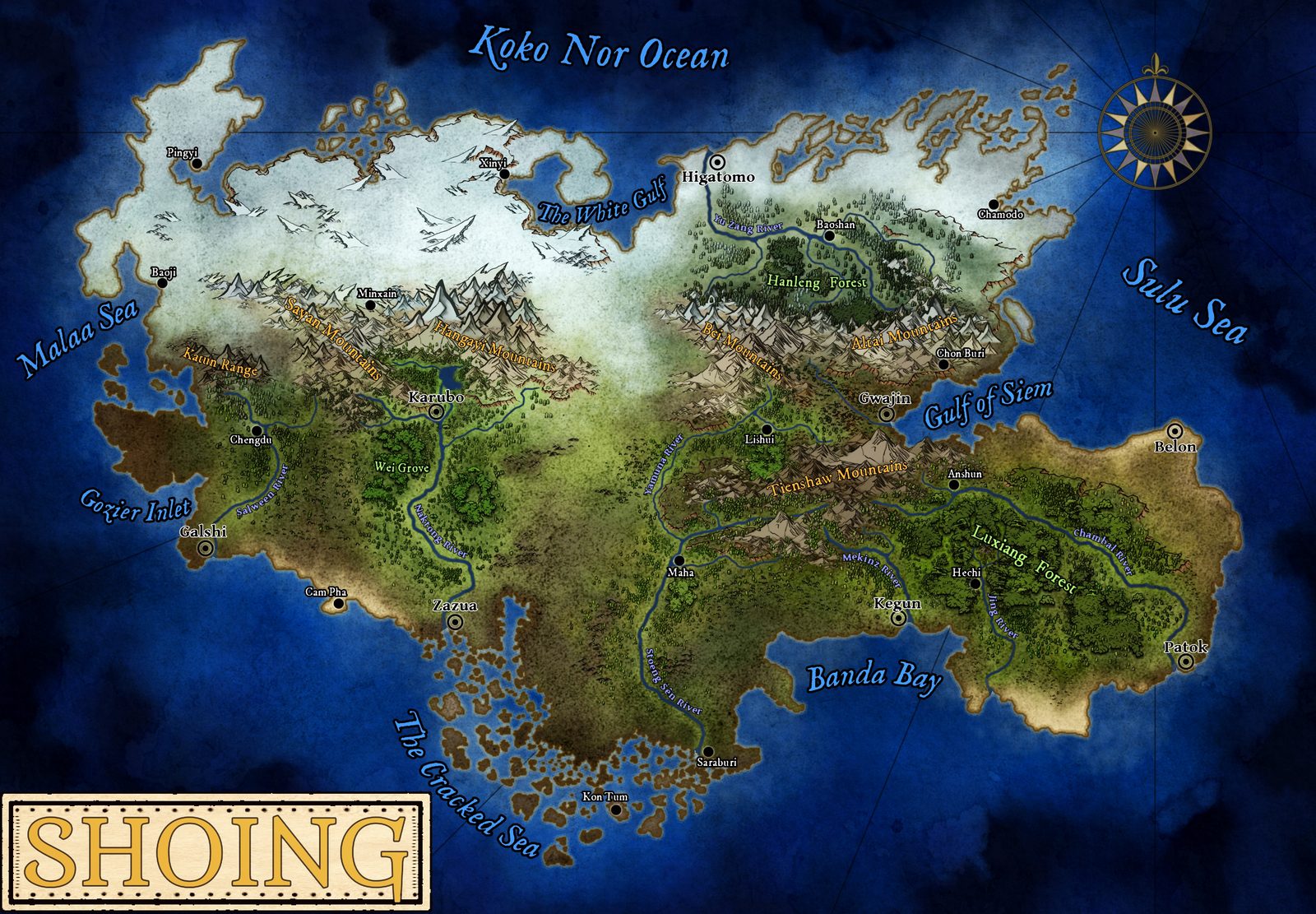
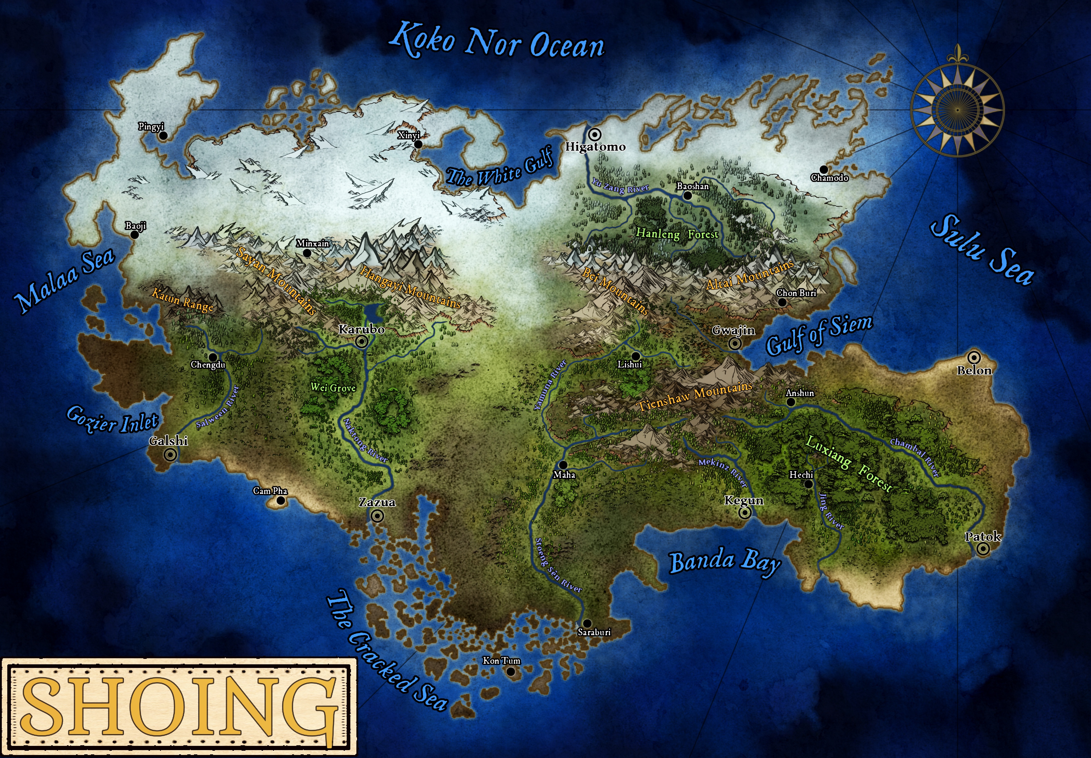
Shoing
Gwajin, the eastern capital, faces the Gulf of Siem. The north is ice; the southern and western lands are warm, wet, and busy with trade.
Map by Luis Leopardi
-
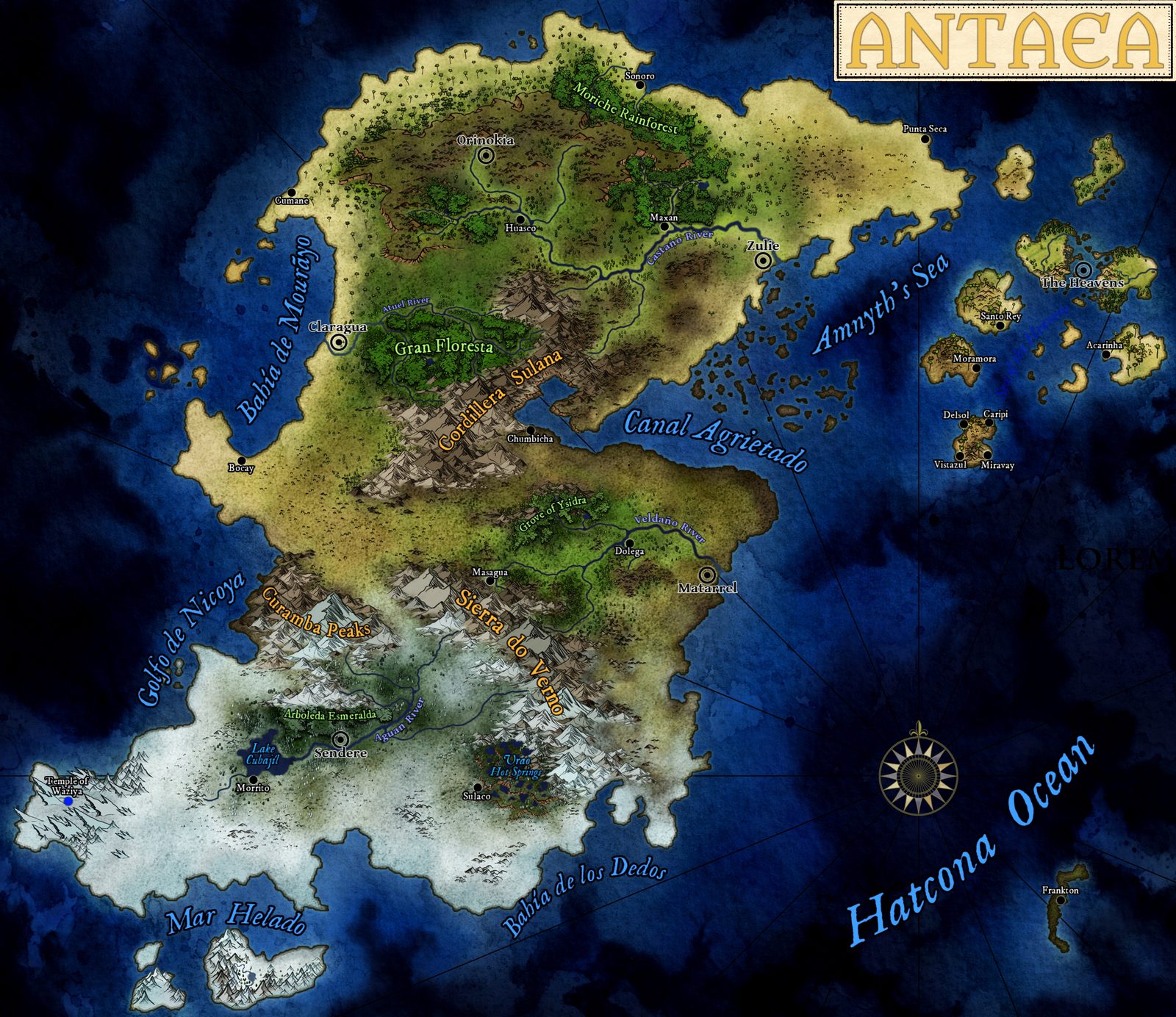
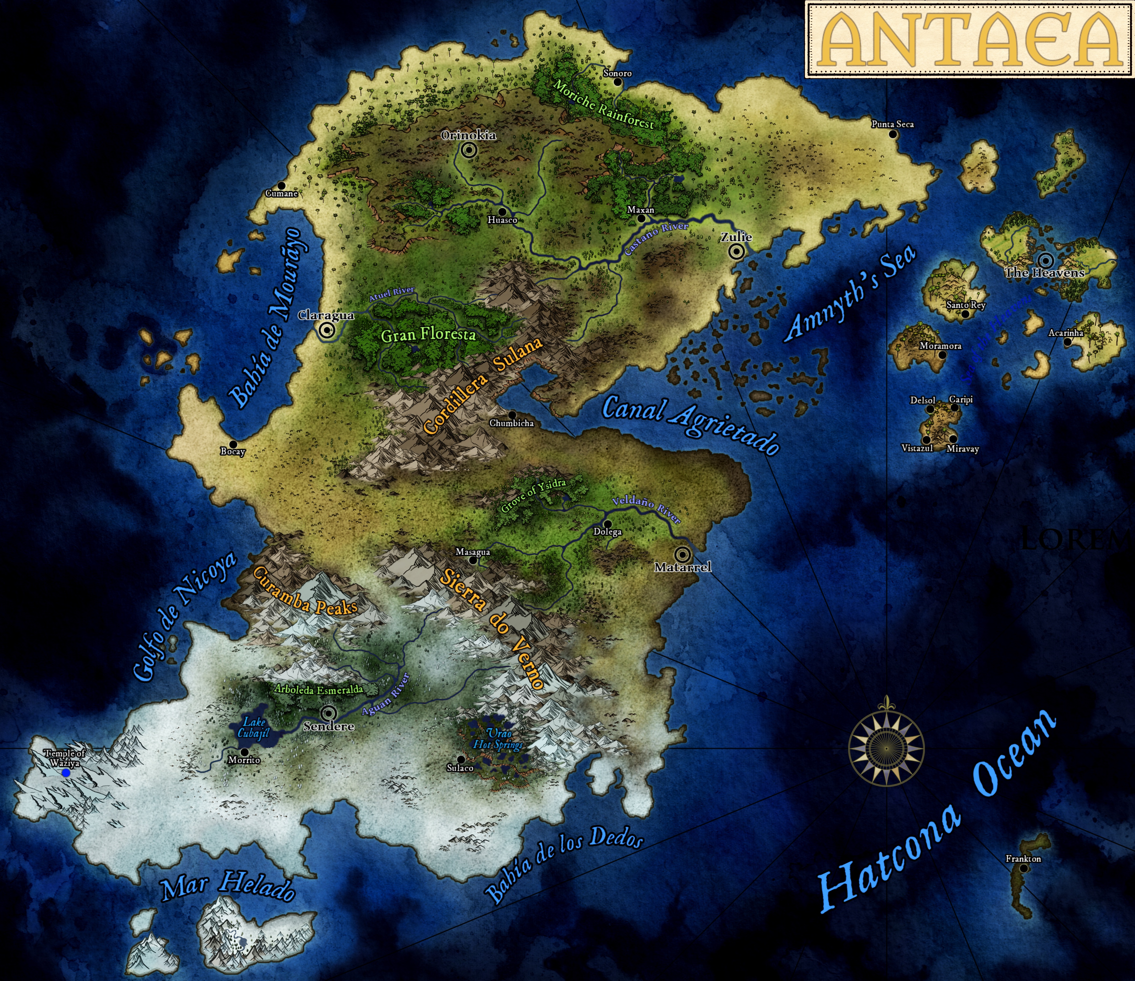
Antaea
A fragmented land with strong regional identities. The Heavens, five floating islands off the northeastern coast, is its neutral ground.
Map by Luis Leopardi
-
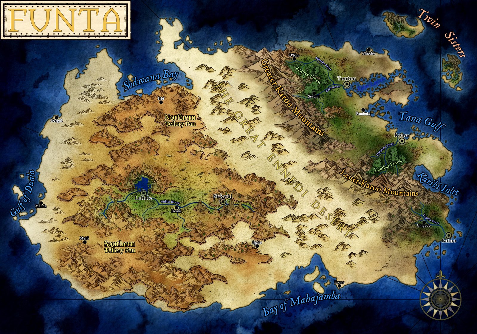
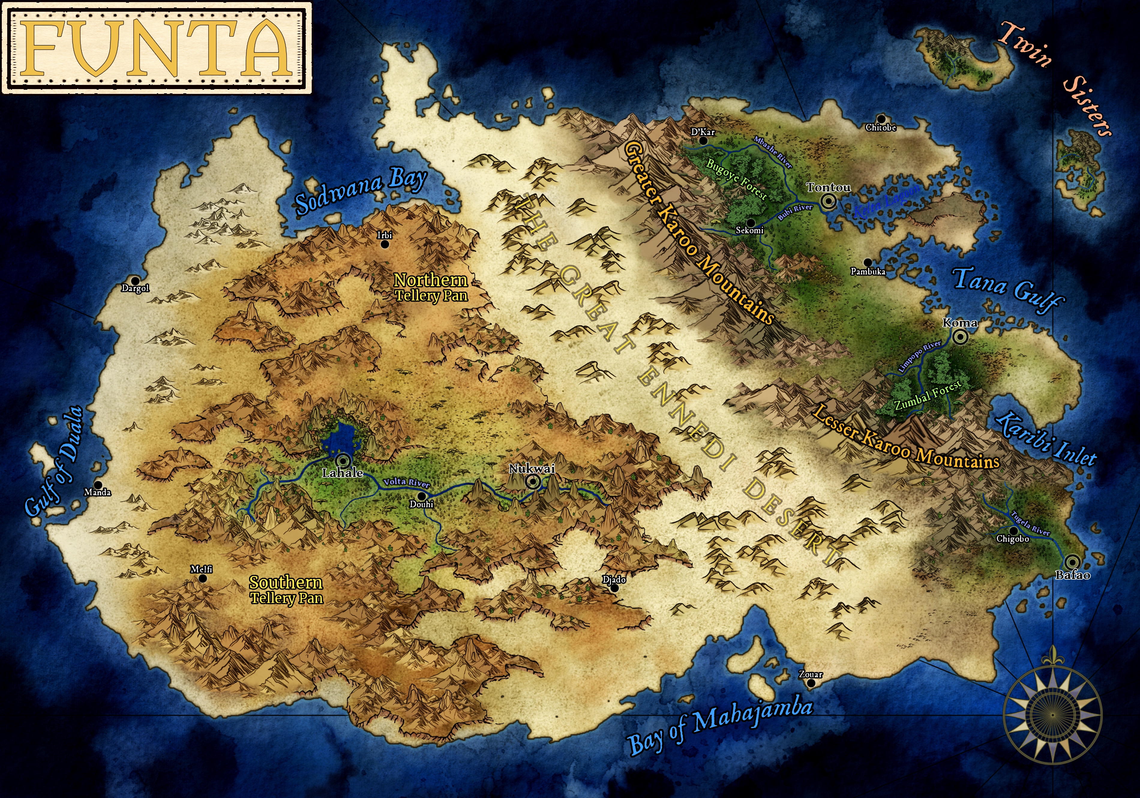
Funta
Deserts, highlands, and river valleys. LaHale, the scholar city, lies on the Volta River in the west; Tontou, Koma, and Bafao hold the eastern coast.
Map by Luis Leopardi
-
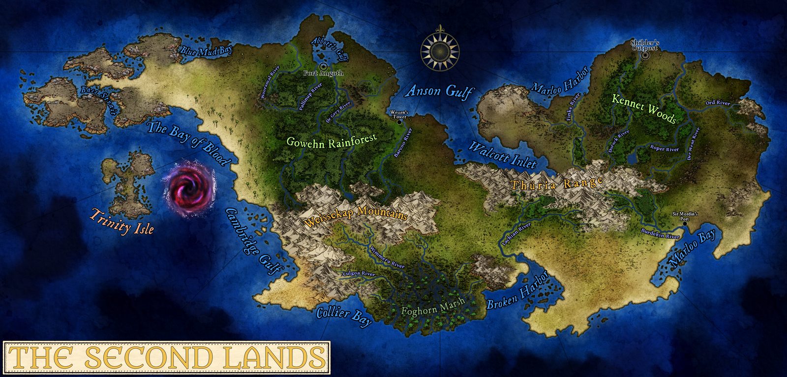
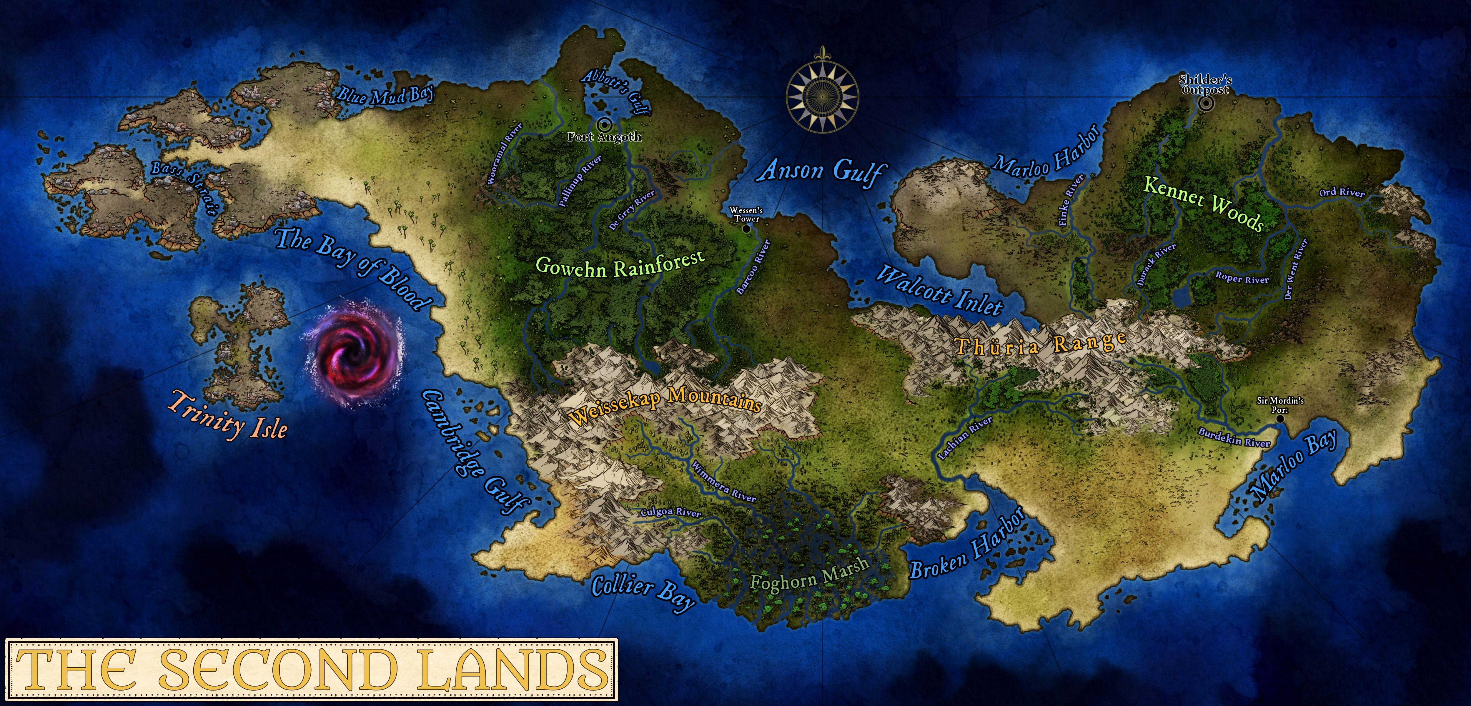
The Second Lands
Vast, dangerous, and poorly controlled, south of Funta. Fort Angoth, Wessen's Tower, Shilder's Outpost, and Sir Mordin's Port hold the coasts; beyond them, routes shift with weather and flood.
Map by Luis Leopardi